Scar House Reservoir Dog Walk
Walk Stats
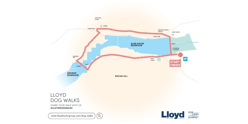
| Start/finish: Yorkshire Water’s Scar House Reservoir car park, Lofthouse, Harrogate HG3 5SW (grid reference SE 069 766) | |||
| Terrain: Surfaced track for first 2 miles (3.2km), then on grass and rough tracks | |||
| Dog-friendly refreshments: The Crown Hotel in nearby Lofthouse | |||
| Notes for dog owners: No stiles; please keep dogs on short leads during spring and summer to protect ground-nesting birds |
Overview
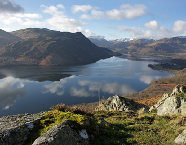
It’s not often walkers get to enjoy such wild and remote scenery for so little effort – in fact, your car will do most of the hard work for you. Scar House Reservoir lies at the end of a sealed access lane that climbs steadily towards the head of Nidderdale, at the heart of the Nidderdale National Landscape.
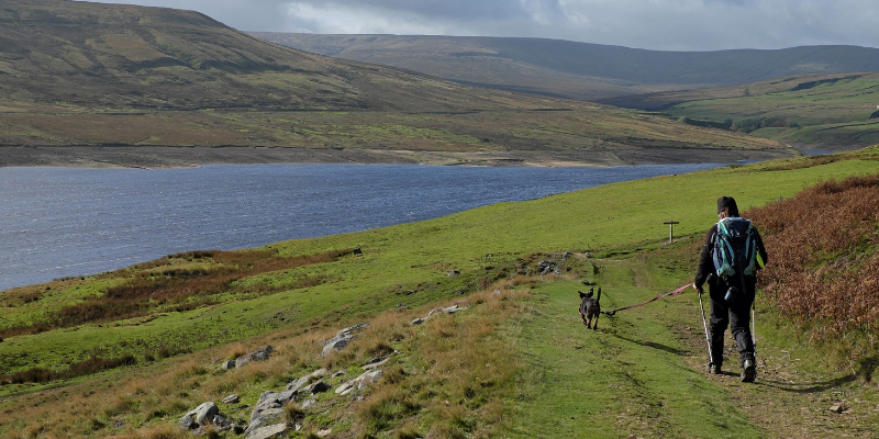
From the Yorkshire Water car park, the walk completes a circuit of the reservoir, tucked in at the base of high, moody hills, and enjoying a visit to an abandoned village along the way. The last time I was here – in late spring – the air was full of the calls of lapwings, skylarks and other birds that build their nests in the surrounding clumps of grass. Eggs and young birds are easily destroyed, so please keep dogs on short leads if visiting at this time of the year.
 Photography: @viviennecrow
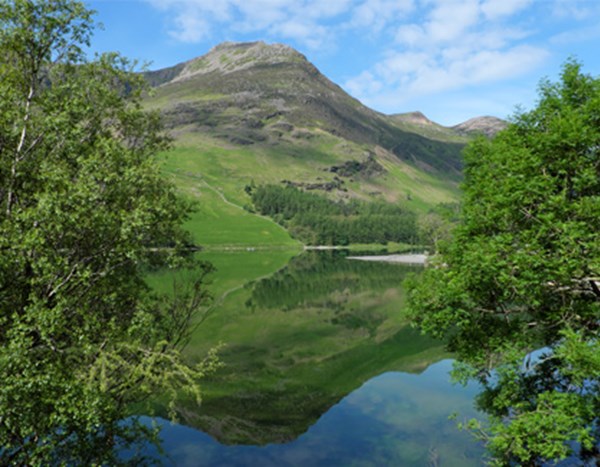
The Walk
From the far end of the car park, turn right to pass The Cabin on your left. Reaching a T-junction with a surfaced track, turn left, and you’ll soon pass Scar House Dam, which forms part of the return route. With the water sparkling below, make your way west along the track.
Nearing the far end of Scar House Reservoir, keep left along the surfaced lane as another track drops to the right. As you then approach Angram Dam, you’ll see a small shelter with seats inside it – a good place to sit out any passing showers. Just after this, go through a gate and turn right to cross the dam.
Angram is the highest of Nidderdale’s chain of three reservoirs, completed in 1919 to supply water to Bradford. I love the view from its dam, with Great Whernside, one of the Yorkshire Dales’ highest hills, looming over the scene.
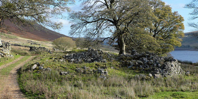
At the far end of the dam, take the path climbing the short, stony embankment on the right to join a broad, grassy path – signposted Lodge, Scar House Circular. Go through four gates and, after a fifth, turn left along a rough, partially walled track. At the next track junction, turn right, soon passing through the abandoned village of Lodge.
When Scar House Reservoir was built, the families living in this isolated community were paid to move away – to avoid potential contamination of Bradford’s water supply. The last people left in 1929.
Photography: @viviennecrow
As the rough track swings right, dropping towards the Scar House Dam, ignore a bridleway to the left. At the bottom of this steeper part of the track, turn right to cross the dam on asphalt. On the far side, ignore the first track on the left; instead continue to a T-junction with a higher, surfaced track and turn left along this to return to the car park where the walk started.
Vivienne Crow has written dozens of walking guidebooks. Her latest include Walking in Northumberland and Lake District: High Level and Fell Walks, both published by Cicerone.
Share your walk #LloydDogWalks on Facebook or Instagram
Browse all walks
Frequently Asked Questions
Yes, Scar House Reservoir is a great walk for dogs, with no stiles on the entire route. Please keep dogs on short leads during spring and summer, however, to protect ground-nesting birds such as lapwings and skylarks in the surrounding grassland.
Yes, there is a car park at the start of the walk at Yorkshire Water's Scar House Reservoir car park, Lofthouse, Harrogate. Satnav postcode: HG3 5SW (grid reference SE 069 766).
The nearest option is The Crown Hotel in the village of Lofthouse, a short drive from the walk, making it a great spot for a post-walk stop.
This is an easy to moderate walk of 4.4 miles (7.1km), taking approximately 2¼ hours. The route follows a surfaced track for the first 2 miles (3.2km), then continues on grass and rough tracks. There are no significant climbs, making it a straightforward and accessible route.