Blake Fell Dog Walk
Walk Stats
| Start/finish: Small car park at Felldyke, Lamplugh CA14 4SH (grid reference NY 085 198) | |||
| Terrain: Road, forest tracks and open fell; mostly on clear paths, except on initial descent | |||
| Dog-friendly refreshments: The Gather café in Ennerdale Bridge, 3.5 miles (5.6km) from the start of the walk | |||
| Notes for dog owners: No stiles; be extra vigilant on the road section at the start of the walk |
Overview
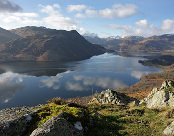
Located on the far western edge of the Lake District, Blake Fell is a wonderful place to sit and gaze out to sea – and when you tire of the views of the Isle of Man and the hills of southern Scotland, you can turn and focus your attention on the high western fells.
As fell walks go, this one’s relatively short and straightforward, suitable for fit and healthy dogs – and their humans. After leaving the road and then following a stony track, it climbs steadily on grass. You now have the security of a fence almost all the way to Blake Fell’s summit shelter so there’s no need to worry about those ever-improving views distracting you from route-finding.
The trickiest part of the route comes on the initial descent where the paths are less clear and the slope is briefly very steep. After that though, a good forest road passes beneath the Blakefell Screes, providing an interesting perspective on Cogra Moss below. A further descent then leads to the shores of the old reservoir.
The Walk
Leaving the car park, turn left along the road. As you steadily ascend, you might be able to see the Isle of Man on a clear day; look over your right shoulder, and it’s the Galloway Hills that draw the eye. Having walked the road for about 0.9 miles (1.4km), go through the large gate set back on the left and head up the broad track.
To the right, running roughly parallel with the track, are the remains of an old mineral railway. As the red tinge to the track suggests, this area was once mined for its iron ore.
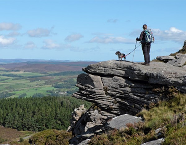
Photography: @viviennecrow
At a green sign welcoming you to Cogra Moss, leave the wide forest road by bearing right along a path running between the fence on your right and the trees on your left. Reaching a gap in the trees, keep right, over muddy ground, to continue with the fence.
The initial climb on to Low Pen, crowned by a tiny cairn, is moderately steep but short lived. A gentler incline then leads up to the unmarked summit of High Pen, the route still keeping faith with the fence. Blake Fell looms on the left; rearing up straight ahead, about four miles away as the crow flies, is the considerably loftier Grasmoor.
Don’t be tempted by the trail cutting left across the Blakefell Screes; simply continue beside the fence for now. As it swings up to the left, the path splits. Bear left to climb directly to Blake Fell’s summit shelter and a chance to rest and enjoy the fantastic views you’ve been ogling on the way up.
From the shelter, the path heads north. There’s a faint trail to the right here too. Ignore it. The clearest path quickly forks. Bear left (north-west). This drops into a dip and forks again at the base of Sharp Knott. Bear right now – heading roughly north – and the path soon begins dropping very steeply. It descends to the edge of a felled area where a broad forestry track is joined. Heading north-west at first, follow this track for about 2 miles (3.2km). It’s easy going, mostly following the same contour across Blake Fell’s western slopes.
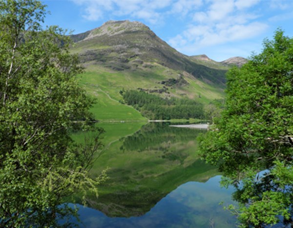
Just before the track swings left to enter a more densely forested area, watch for a narrow trail dropping to the right – it’s unmarked and easy to miss. With trees to the left and felled ground to the right, follow this down to a path near the edge of the old Cogra Moss reservoir and turn left.
Cogra Moss became a reservoir supplying water for nearby towns and villages after Rakegill Beck was dammed in the 19th century. This role ceased in 1975 and then, in 2015, when it was discovered that the dam needed repairing, United Utilities considered draining the moss. Local anglers and ramblers were among those who fought the proposals, persuading the company to abandon its plans.
The path broadens and becomes a vehicle track that leads to the edge of Felldyke. Turn left at a T-junction and then descend the steps on the right to follow the path back to the car park.
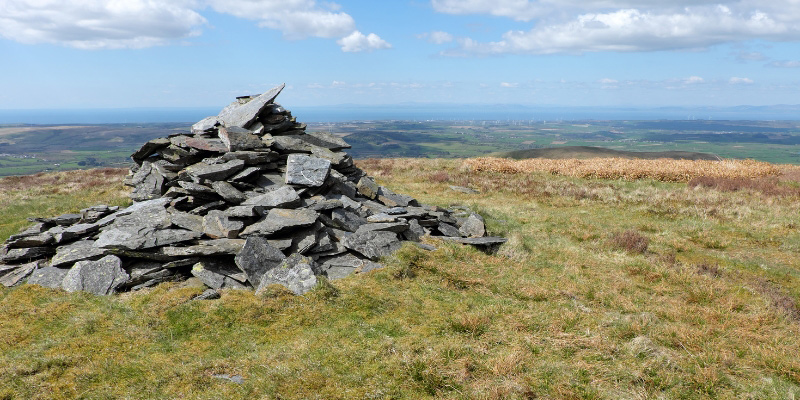
Photography: @viviennecrow
Vivienne Crow has written a number of Lake District guidebooks. Her latest titles include Outstanding Walks Lake District, published by Ordnance Survey.
Share your walk #LloydDogWalks on Facebook or Instagram
Browse all walks
Frequently Asked Questions
Yes, Blake Fell is a great walk for fit and healthy dogs, with no stiles on the entire route. Do be extra vigilant during the road section at the start of the walk, and note that the initial descent includes a briefly very steep slope where paths are less clear.
Yes, there is a small car park at the start of the walk at Felldyke, Lamplugh. Satnav postcode: CA14 4SH (grid reference NY 085 198).
The nearest option is The Gather café in Ennerdale Bridge, approximately 3.5 miles (5.6km) from the start of the walk — a great spot for a post-walk coffee.
This is a moderate to hard walk of 6.8 miles (11km), taking approximately 4 hours. The route follows road, forest tracks and open fell on mostly clear paths, with the exception of the initial descent which is briefly very steep.
We have many retail centres nearby in Cockermouth and Workington. See opening times and directions, and browse our current range of vehicles.