Carrock Fell and High Pike Dog Walk
Walk Stats
| Start/finish: Small roadside parking area at Calebreck, 2 miles (3.2km) south of Hesket Newmarket (grid reference NY 346 358) | |||
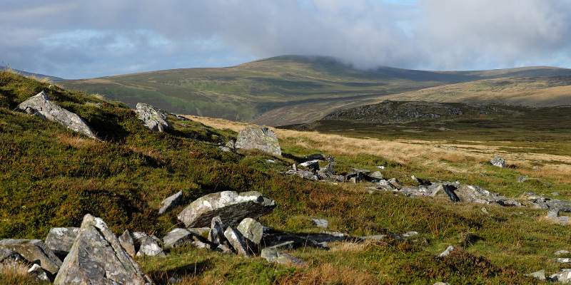
| Terrain: Short section on quiet, unfenced road; otherwise, all on grassy, open fell with some boggy patches | |||
| Dog-friendly refreshments: The Old Crown pub in nearby Hesket Newmarket | |||
| Notes for dog owners: No stiles; sheep and fell ponies might be encountered |
Overview
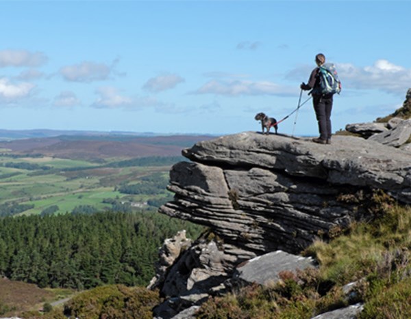
I’ve probably been up High Pike more than any other hill. It’s where we take friends when they come to stay; it’s where I go when I’m tired and can’t manage much else; it also becomes a safer option when the snow falls and attempting the higher fells becomes more like an Alpine expedition. It’s a grassy hill with smooth slopes but combining it with Carrock Fell adds slightly steeper ground, a little more rock and a splash or two of bog.
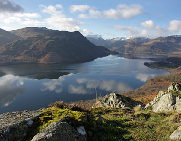
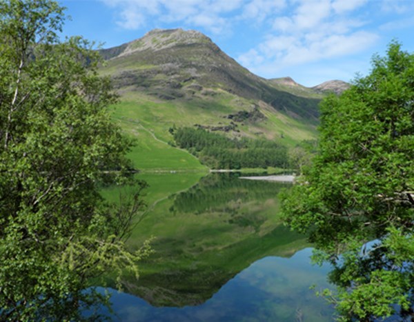
The views from both summits are wonderful, each in its own way. From Carrock Fell, you’re likely to look east, over the Eden Valley to the North Pennines, or south-west, along the River Caldew’s deep trench to Skiddaw; on High Pike, eyes will be drawn either south-west into the heart of the Lakes, or north, to the Scottish hills.
The Walk
From the parking area, walk south-east along the road. Cross the footbridge beside the ford over Carrock Beck, continue on the road for about 70 yards (65 metres) and then head up to the right (west) to find a path through the bracken. At the top of the first short rise, you’ll see the gully created by Carrock Beck on your right. Walk parallel with the beck, the trail becoming less obvious on damp ground.
Photography: @viviennecrow
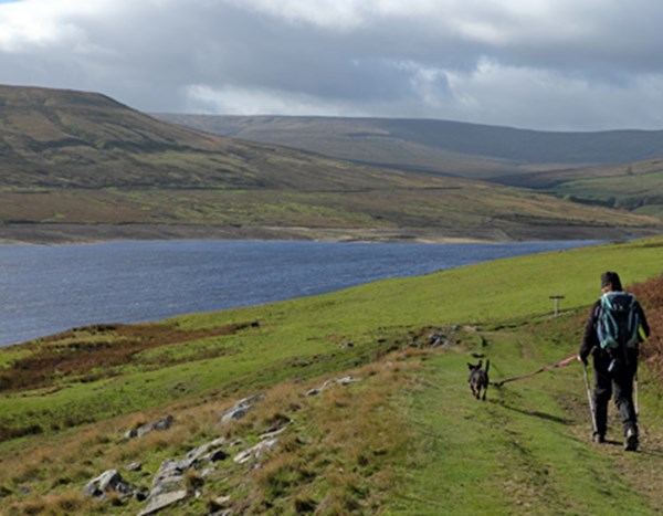
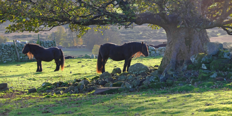
Fell ponies, which can trace their ancestry back to Roman times, can often be seen grazing the lower ground in this area. These hardy animals aren’t wild ponies; they belong to local breeders but, like sheep, are ‘hefted’ to particular areas of common land and wander freely for much of their lives. The ponies tend to have calm natures but, unless your dog is used to equines, you should be cautious around them.
About 350 yards (320 metres) beyond the road, the trail passes to the left of two small, grassy mounds and then swings left (south-south-west) to begin a steep but grassy ascent. Later, with a bouldery slope to the left, the gradient eases. Just before the top of the ridge, bear left at a faint fork, the trail threading its way through boulders to Carrock Fell’s summit cairn.
Carrock Fell was once home to an Iron Age hill fort, thought to have been built by the Brigantes, a Celtic tribe that once dominated northern England. It commanded an excellent vantage point over the surrounding countryside with particularly good views to the north and the east. Little of the fort stands today, but look around and you may get a sense of how it was laid out.
Photography: @viviennecrow
From the summit cairn, retrace your steps, but only for about 90 yards (82m). Then, at a faint fork, keep left (west). At the bottom of the rocky slope, bear right at another faint fork to take the most obvious path west-north-west across the peaty plateau. It braids whenever it encounters boggy ground, which is fairly frequently. As long as you keep heading for the smooth, grassy ‘bump’ of Miton Hill, which is slightly less than one mile (1.6km) north-west of Carrock Fell’s summit, you shouldn’t go wrong. Miton Hill is so small though that, as you near it, you are barely aware of having climbed at all. The biggest clue to its existence is that the ground becomes considerably drier.
Beyond here, you’re on a much improved, grassy path across the open, expansive moorland. This drops into a dip at the top of the Red Gate track. Ignore the track to the right here; simply keep straight on, climbing gently again. Ignoring any left turns, stay on the main path as it curves around the head of the valley and then makes for High Pike. Cross a wide gravel track to continue to the summit, adorned by a bench, a trig pillar and a cairn-cum-shelter.
There are several paths radiating out from the summit furniture. Take the broad, grassy route heading north-east. This drops to a stony track near some mine openings.
Cross the track diagonally left to continue in roughly the same direction. Negotiating mine debris, the path passes to the right of a fenced mine opening and then crosses the top of steep-sided gully. Immediately after this, another path joins from the left – don’t be tempted to head down to the right here – and the way ahead (east) becomes grassy again. Bear left at a fork in another 140 yards (128m).
Descending the eastern side of West Fell, go straight over any grassy path crossings. Sheep could be encountered at any point on this walk, but numbers are usually highest in this area. Turn right when you reach a stony track at the base of the fell, soon returning to the parking area at Calebreck.
Vivienne Crow has written a number of Lake District guidebooks. Her latest titles include Outstanding Walks Lake District, published by Ordnance Survey.
Share your walk #LloydDogWalks on Facebook or Instagram
Browse all walks
Frequently Asked Questions
Yes, Carrock Fell and High Pike is a great walk for dogs, with no stiles on the entire route. Sheep and fell ponies may be encountered, so keep dogs under close control. Take extra care around the old mine workings near High Pike's summit, where sheer-sided pits and open tunnel entrances can pose a risk.
Yes, there is a small roadside parking area at the start of the walk at Calebreck, approximately 2 miles (3.2km) south of Hesket Newmarket (grid reference NY 346 358).
The nearest option is The Old Crown pub in nearby Hesket Newmarket, making it a great spot for a post-walk pint.
This is a moderate to hard walk of 5.8 miles (9.3km), taking approximately 3¾ hours. The route follows grassy, open fell with some boggy patches and a short section on a quiet, unfenced road.