Simonside Hills Walk
Walk Stats
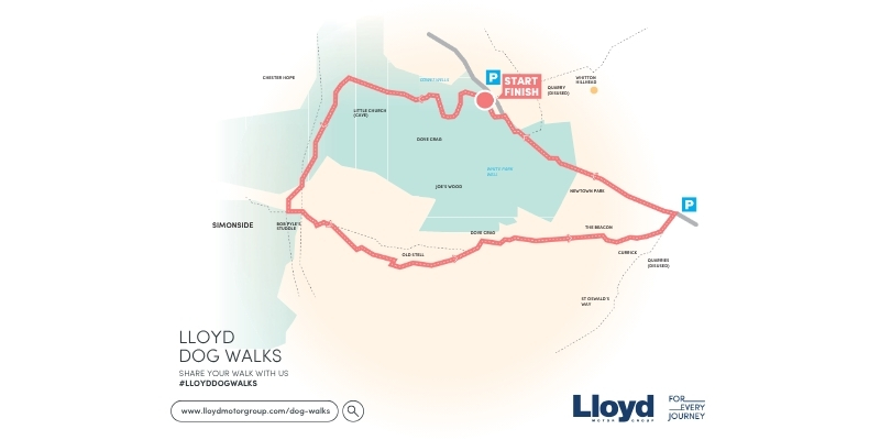
| Start/finish: Forestry England’s Simonside car park, Great Tosson, Morpeth (grid reference NZ 037 997) | |||
| Terrain: Forestry tracks and trails; clear path on open moorland; short section along quiet road | |||
| Dog-friendly refreshments: Several pubs in nearby Rothbury, about 3 miles (4.8km) from the start of the walk | |||
| Notes for dog owners: No stiles; few water sources, so owners are advised to carry water for their dogs |
download pdf map
Overview
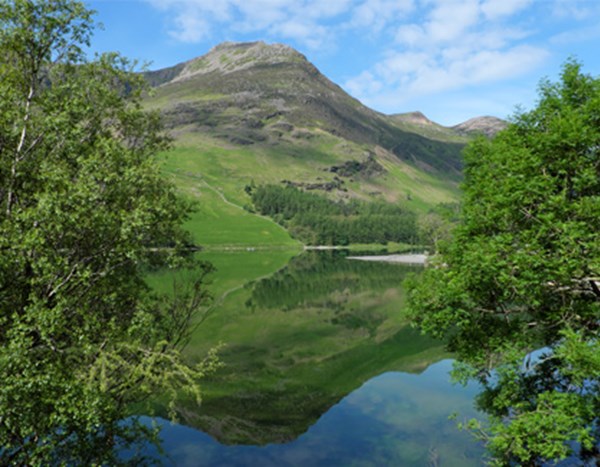
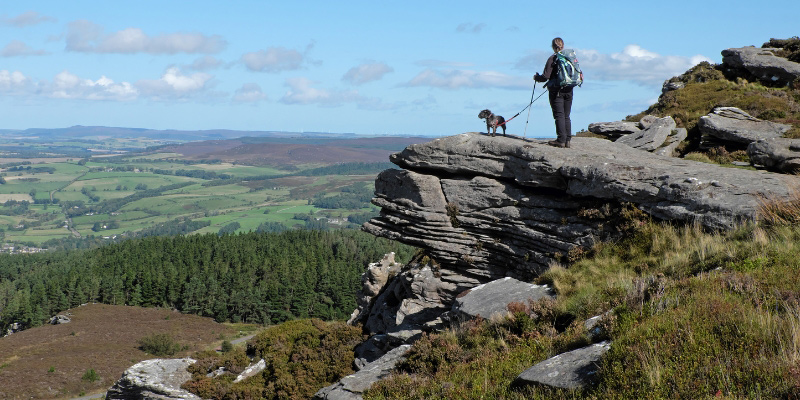
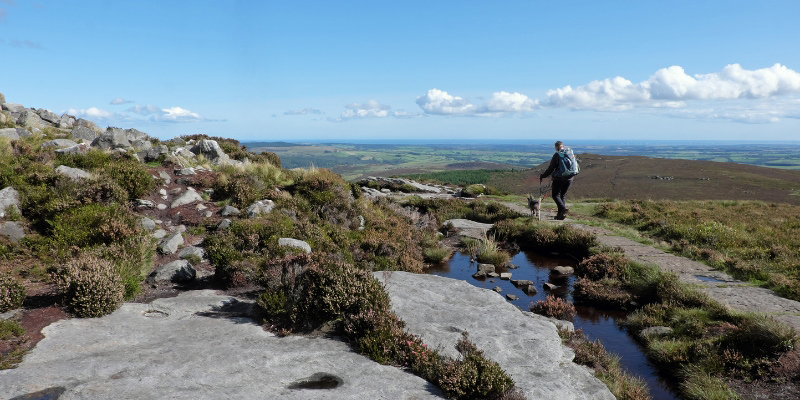
Poking their sandstone-studded heads above Rothbury’s dark forests, the Simonside Hills provide some of the best, and most easily accessed, ridge walking in Northumberland. After following clear tracks through the conifers, this walk climbs to the moorland for some far-reaching views and a brush with antiquity. The tor-like rock formations and the archaeology make this a fascinating walk at any time of year, but it’s especially beautiful in mid to late summer when the flowering heather covers the moors in a purple carpet.
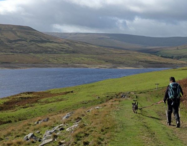
Most dogs will happily drink from rivers or streams while out walking, but there aren’t many water sources on this walk – and it’s also worth remembering that our pets are susceptible to the same bugs and parasites that we can pick up from water. (Moving water is always better than a stagnant pool.) Carry a collapsible bowl or other form of easily-accessible water container so that your dog can share your water if they need to.
 Photography: @viviennecrow
The Walk
With your back to the car park’s entrance and facing the information panel, take the broad forest path on the right. This is part of Forestry England’s waymarked red trail, followed for the first 1.5 miles (2.4km) of the walk. Reaching a junction near a tall mast, turn right and then go left at the next clear junction of tracks. The forest track climbs steadily and, on cresting a slight rise, you can see the path ahead making its way up on to the Simonside Hills’ open heather moorland.
A faint trail on the left here makes for an interesting detour of about 330 yards (300m). It leads to Little Church Rock, which used to be a place of clandestine religious gatherings.
Continuing on the main route, bear left at a waymarker post, still following the red route as it heads uphill. The path follows a deep cut through the heather and bracken. Where the red route goes left, keep right, soon reaching a broad track. Turn left here.
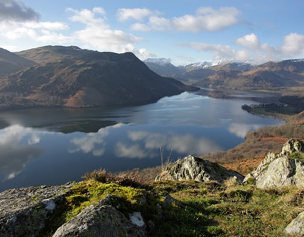
When the track bends left, turn right and immediately take the route climbing left. A pitched path climbs steeply to the summit of Simonside – at 1,410ft (430m) above sea level, the highest point on the walk. Topped by a cairn, it enjoys some outstanding views of the Cheviot Hills to the north-west and the distant North Sea to the east.
The flagstone path keeps to the high ground as it makes its way roughly east along the ridge, passing more weather-sculpted sandstone outcrops along the way and then descending through Old Stell Crag. The next summit is Dove Crag, topped by a sprawling Bronze Age burial cairn perched close to the precipitous edge.
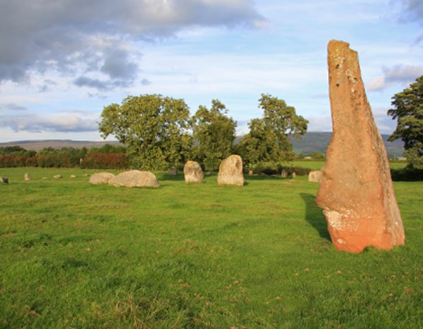
On the descent from Dove Crag, as a waymarked forestry route goes left, keep right. A pitched path drops to a gate. Continue beyond this to the ridge’s final summit, The Beacon, also topped by an ancient cairn. As you then descend, more of the area’s history is revealed, with the ramparts of the Lordenshaw Iron Age hillfort clearly visible on the far side of the road. Bear left at a waymarked junction to reach the road.
The main route goes left at the road, but it’s worth spending some time exploring the fascinating archaeological landscape to the north first. As well as the 2,000-year-old fort, there are several boulders bearing cup-and-ring marks. In an ever-changing world, I always find it amazing that such artefacts have survived for so many centuries – this so-called ‘rock art’ is at least 3,500 years old!
Photography: @viviennecrow
Back on the main route, walk north-west along the road. Soon after crossing a cattle grid – with a gate beside it for dogs – turn left at a forestry sign and immediately right along a grassy path. This waymarked trail leads back to the car park where the walk started.
Vivienne Crow has written several guides to Northumberland, including Walking in Northumberland and 15 Short Walks Northumberland, both published by Cicerone.
Share your walk #LloydDogWalks on Facebook or Instagram
Browse all walks
Frequently Asked Questions
Yes, Simonside Hills is a great walk for dogs, with no stiles on the entire route. There are few water sources along the way, so it's advisable to carry water and a collapsible bowl for your dog. Keep them under close control on the open moorland.
Yes, there is a car park at the start of the walk at Forestry England's Simonside car park, Great Tosson, near Morpeth. Grid reference: NZ 037 997.
Several pubs in nearby Rothbury, approximately 3 miles (4.8km) from the start of the walk, make a great spot for a post-walk stop.
This is a moderate walk of 5.1 miles (8.2km), taking approximately 3 hours. The route follows forestry tracks and clear moorland paths, with a steep climb to the summit of Simonside at 1,410ft (430m). Some sections are exposed on the ridge.
We have many retail centres nearby in Newcastle and North Tyneside. See opening times and directions, and browse our current range of vehicles.